Examples
Radar coverage map examples
Each map below is a screenshot of a run on the live platform, made with generic radar and target presets. Colour shows detection probability for the chosen target; unshaded ground is out of coverage, usually because terrain blocks the path from the radar.
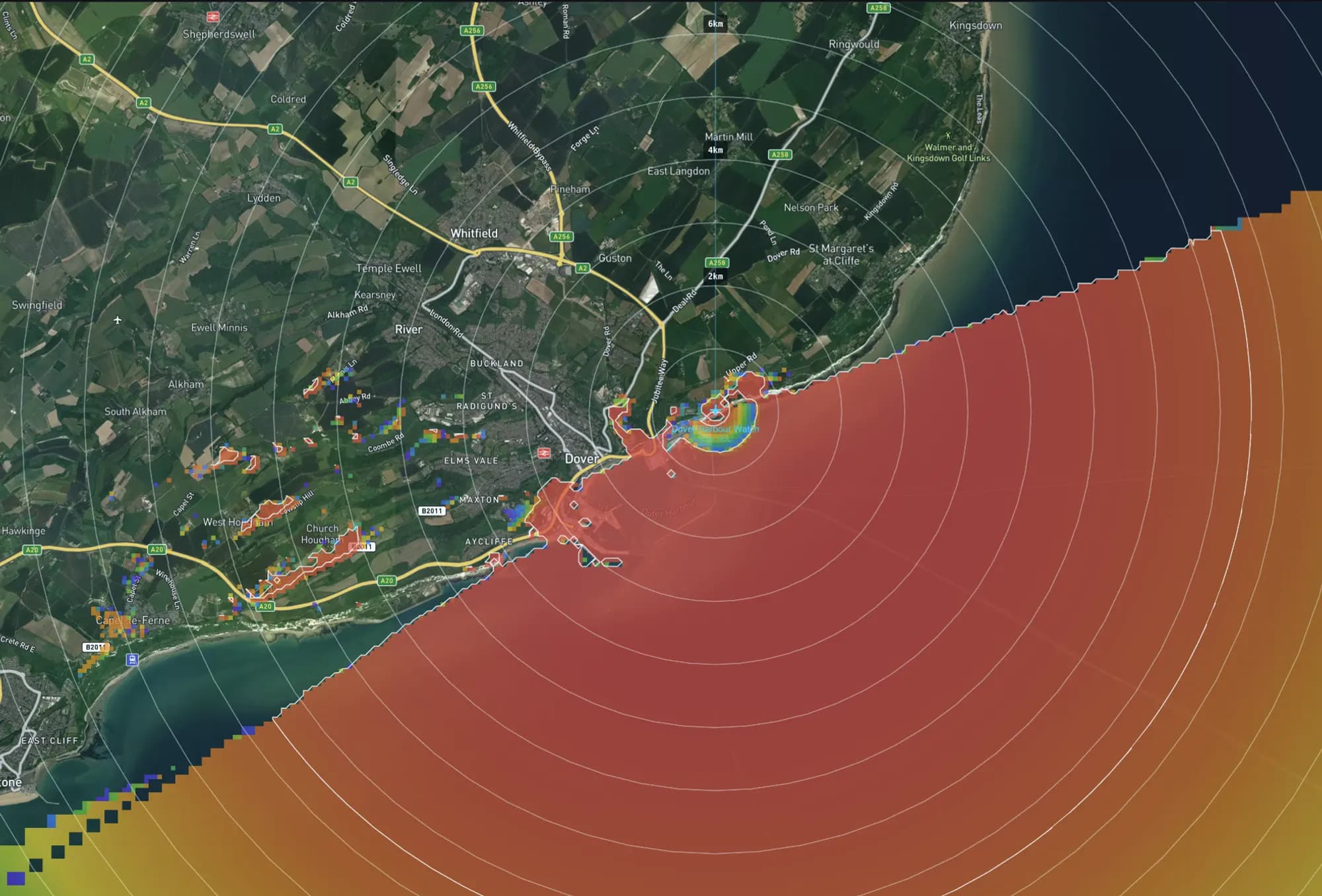
Dover Strait, United Kingdom
Coastal radar coverage map
Detection probability over the sea from a 25 m cliff-top radar site at Dover. Inland, only the hillsides facing the radar are covered; terrain masks the rest.
Radar coverage analysis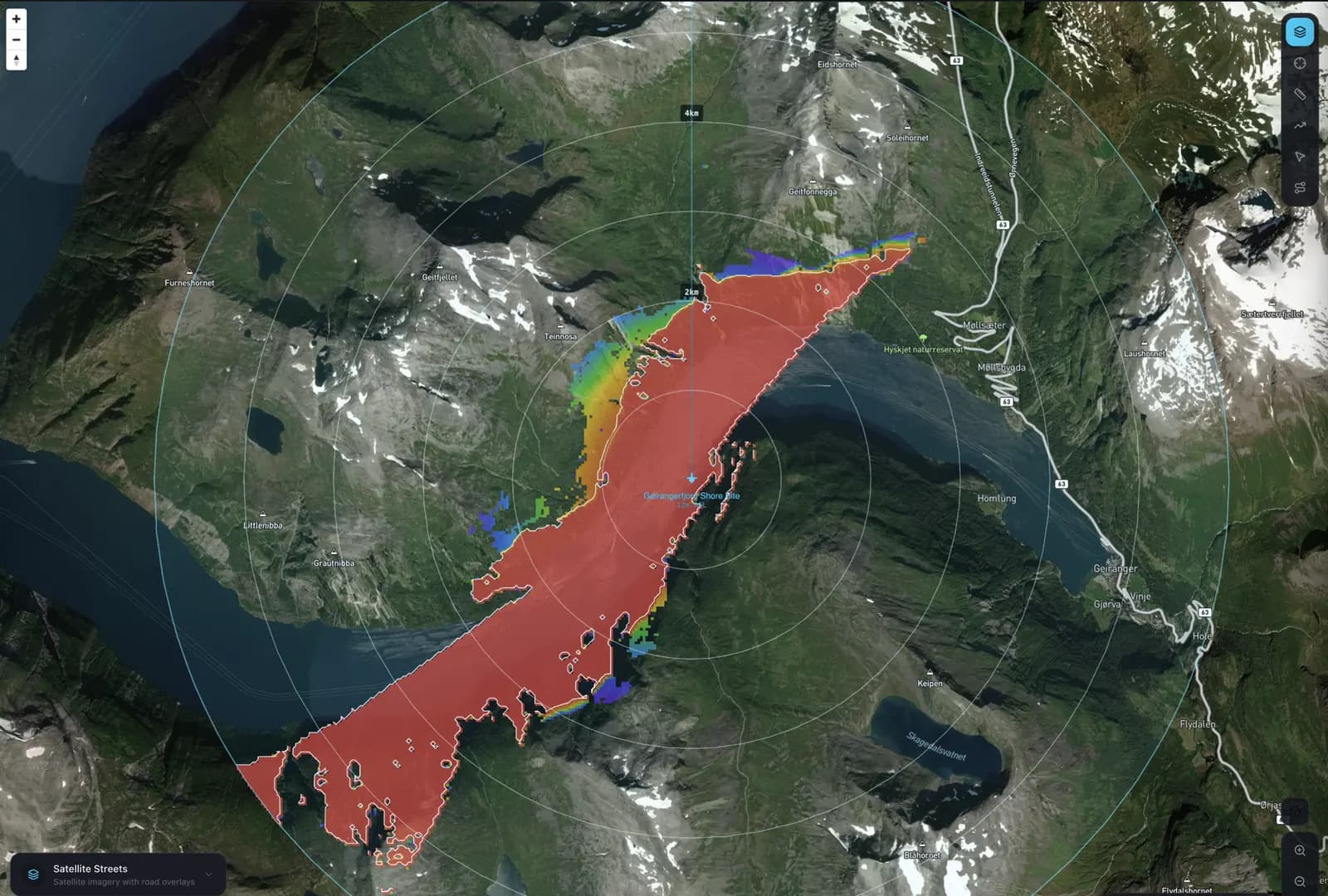
Geirangerfjord, Norway
Maritime radar coverage in a fjord
A fishing-vessel target seen from a 12 m shore site. The fjord walls keep coverage on the water the radar can actually see.
Propagation models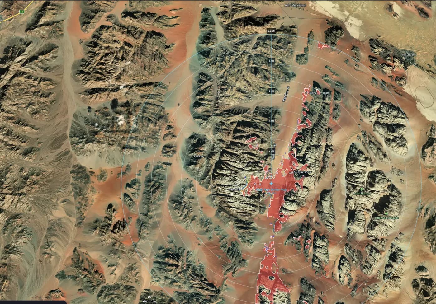
Wadi Rum, Jordan
Terrain-aware ground radar detection
Each cell gets a path profile from the radar over real elevation, so masking by ridges and valley walls shows up as gaps in the map.
Propagation models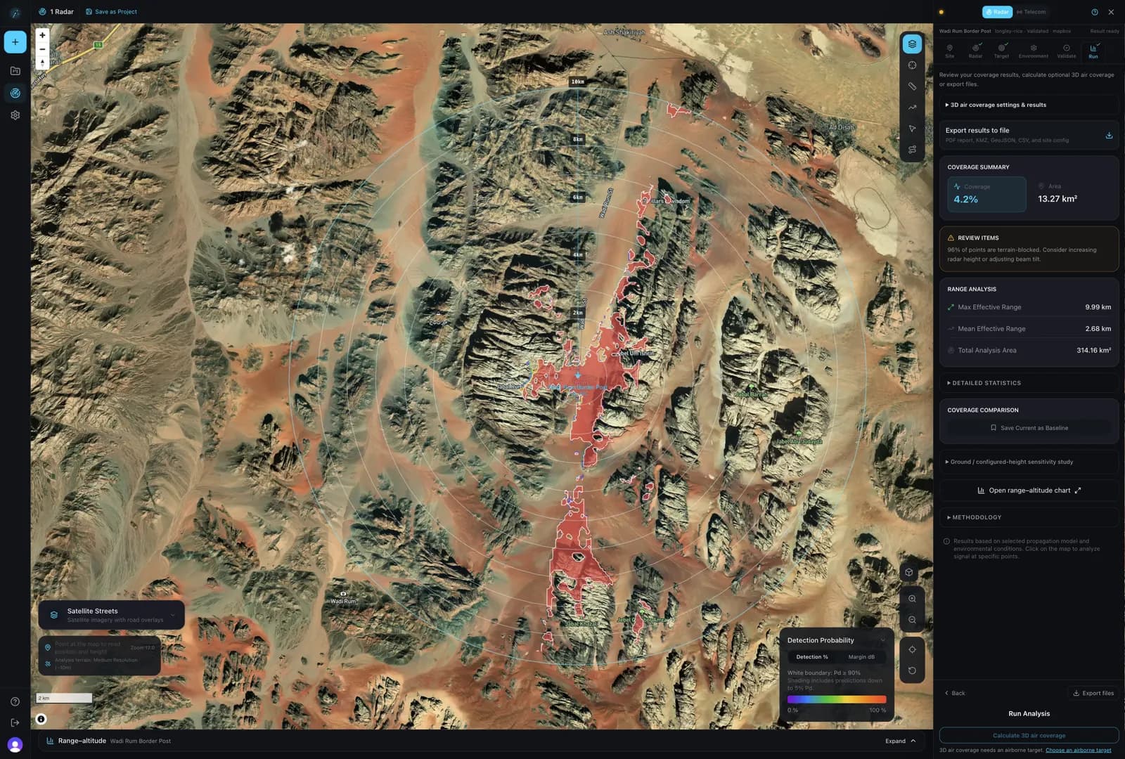
Wadi Rum, Jordan
Ground surveillance radar in the desert
A vehicle target among desert massifs. Coverage follows the wadi floor between the jebels, and the results panel reports covered area and effective range.
Radar coverage analysis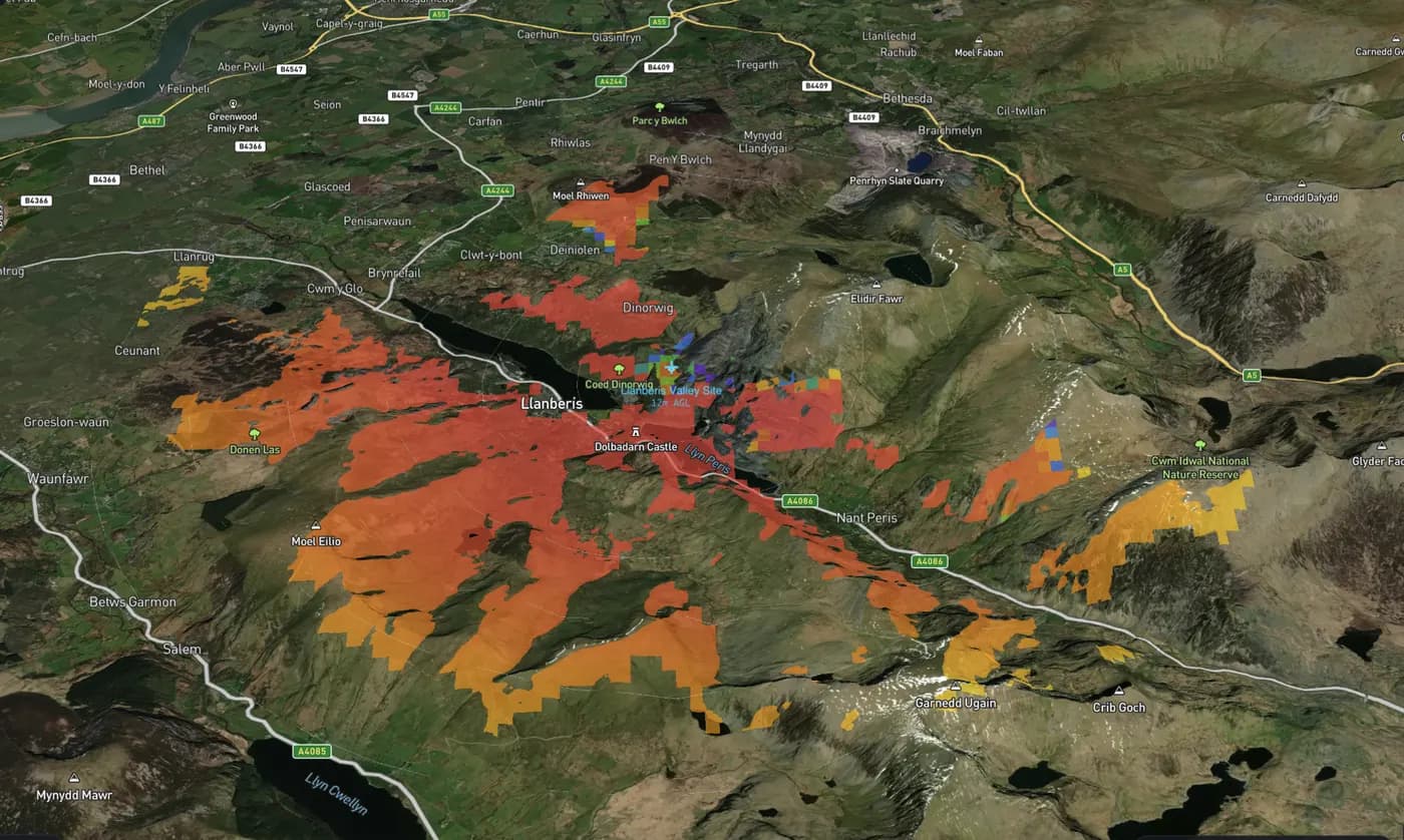
Llanberis Pass, Wales
Drone detection coverage over 3D terrain
Computed air coverage for a medium drone over a steep Welsh valley. Ridges leave unshaded gaps where the radar cannot see the drone.
Computed air coverage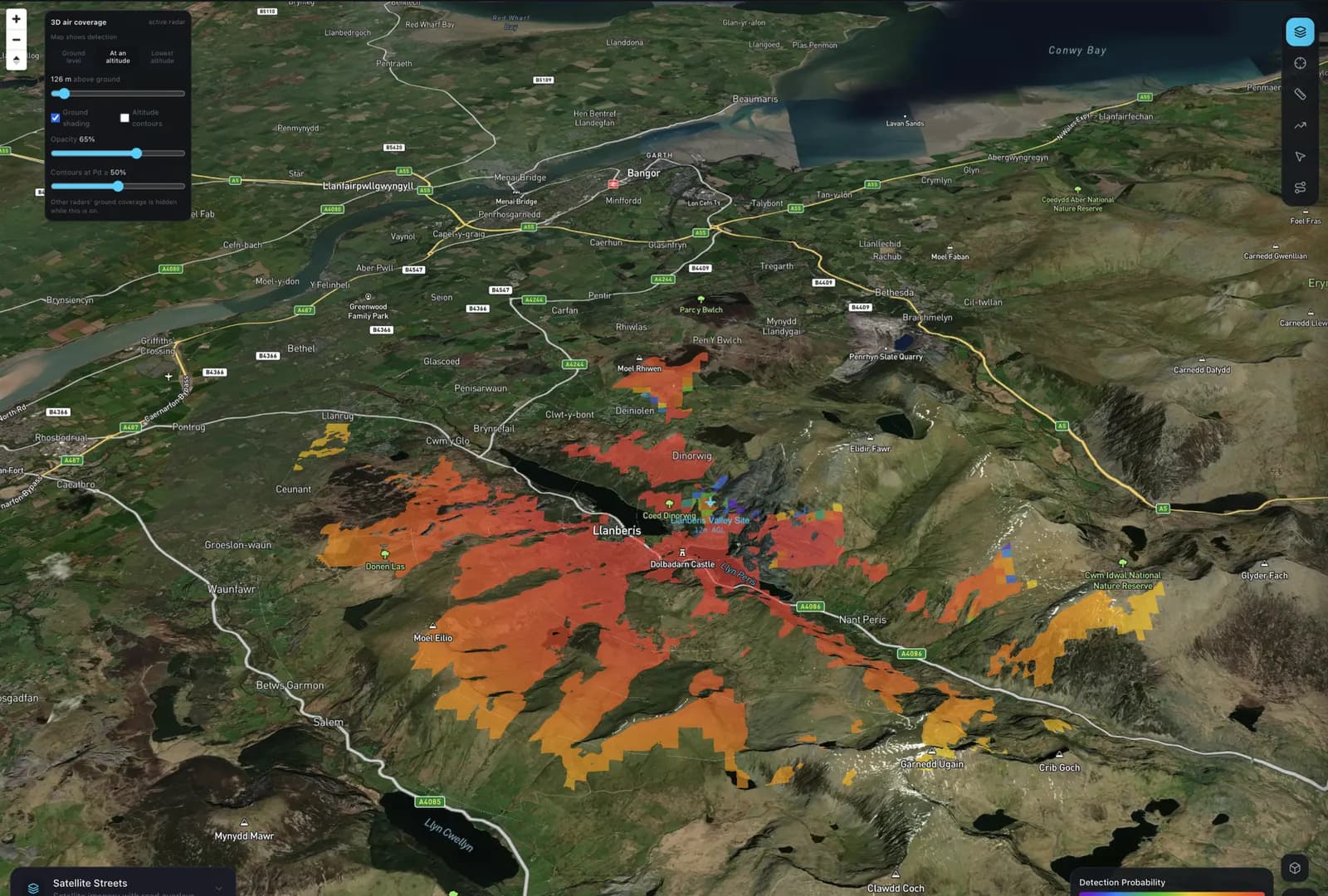
Llanberis Pass, Wales
3D drone radar coverage
Detection probability for a medium drone at 126 m above ground, draped over 3D terrain. The view switches between ground level, any altitude and the lowest detectable altitude.
Technology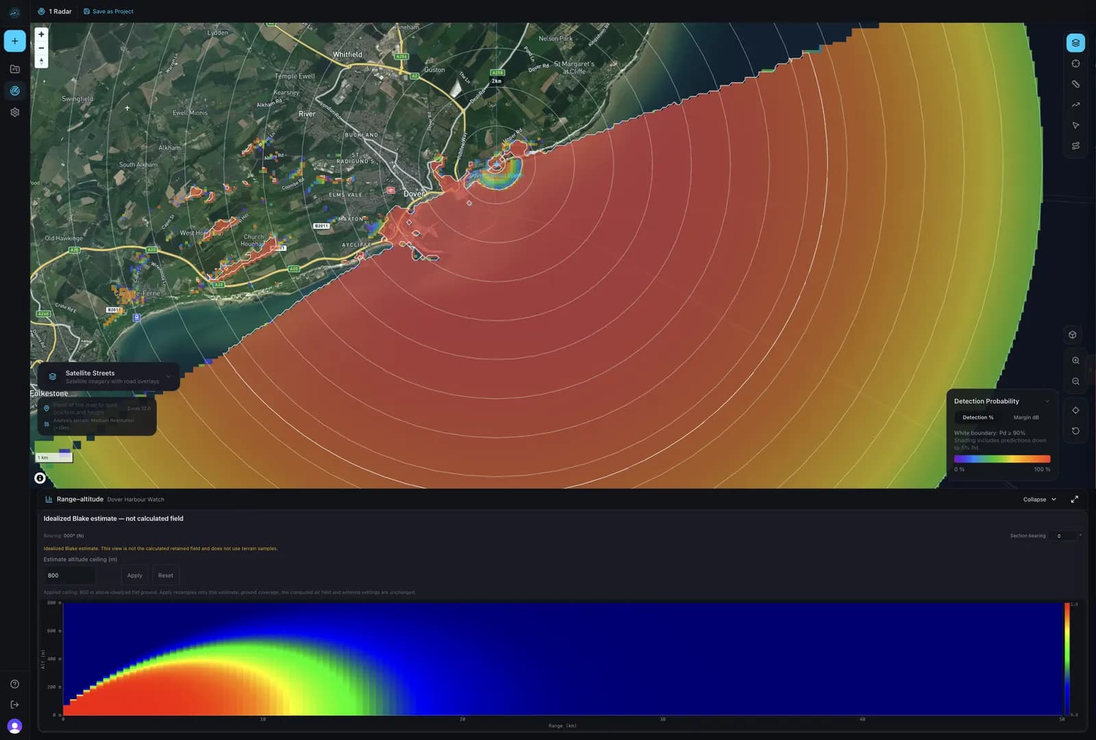
Dover Strait, United Kingdom
Range–altitude coverage section
A range–altitude view of the antenna's coverage beneath the ground map. This one is the idealised Blake estimate, labelled as such in the app.
Methodology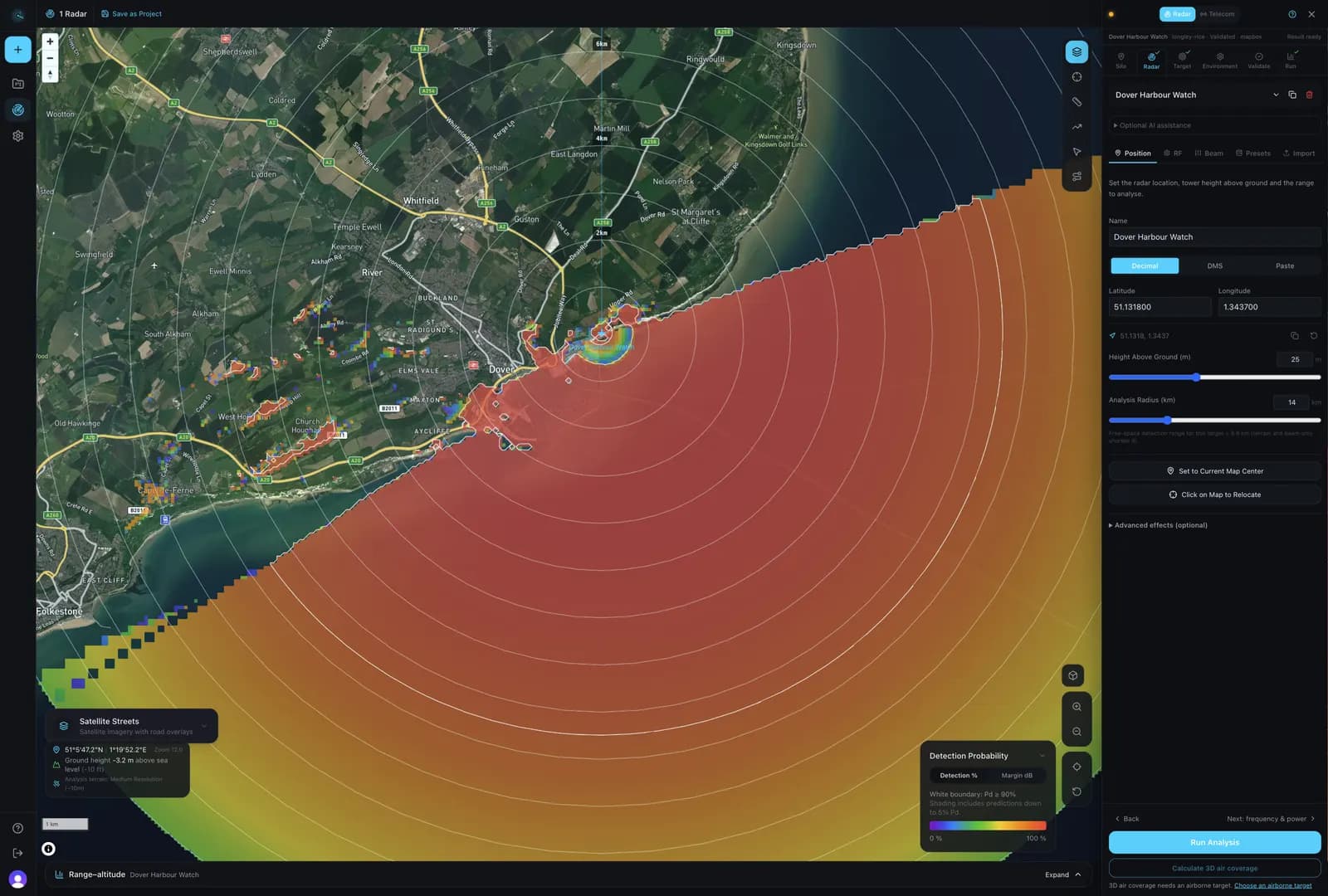
Dover Strait, United Kingdom
Coastal surveillance workspace
The same coastal run in the workspace. The configuration column holds the radar's position, mast height and analysis radius.
Radar coverage analysisMap your own site
Place a radar, choose a target and run the same calculation for your location.