Product truth
New CPU runs use ITU-R P.676-13 Annex 1 line-by-line specific attenuation over a homogeneous slant path with the supplied weather conditions. Below 1 GHz, the run records the legacy P.676-10 closed-form planning approximation as an explicitly identified extrapolation below that method's documented 1–350 GHz domain. Historical unversioned results retain their recorded method.
Methodology & fidelity
Axiorad is a planning-grade radar coverage and RF propagation tool. Results are for site planning and comparative studies. They are not a substitute for field measurement, flight trial, or certified prediction for safety-critical decisions unless independently validated for your scenario.
Fidelity categories
The same labels appear in the Mission Inspector, results provenance, and exports.
Validated
Compared against independent official reference vectors within a declared tolerance for the supported configuration space.
Planning-grade
Suitable for site planning and comparative studies. Mechanisms are standards-based but not fully externally validated for every path.
Approximate
Analytical or simplified implementation. Use for screening only; expect material error outside the documented domain.
Idealized
Theoretical baseline that ignores terrain, clutter, and many real-world impairments. Not a prediction of field performance.
Propagation models
- longley-riceValidated
- itu-r-p1812Planning-grade
- cost231-hataApproximate
- two-rayApproximate
- free-spaceIdealized
- autoPlanning-grade
NTIA ITM WASM is compared against official NTIA example vectors via npm run validate:itm. ITU-R P.1812-6 requires a real terrain profile and is blocked for air-ground geometries. P.528 in the fallback chain is an analytical approximation, not the NTIA table set.
What leaves the browser
Coverage grids are computed in the browser by the authoritative CPU worker. Map tiles, elevation APIs, authentication (Clerk), and optional datasheet LLM parsing do contact external services. Do not treat Axiorad as fully air-gapped or as "data never leaves the browser" without reading the security page.
Computed air coverage
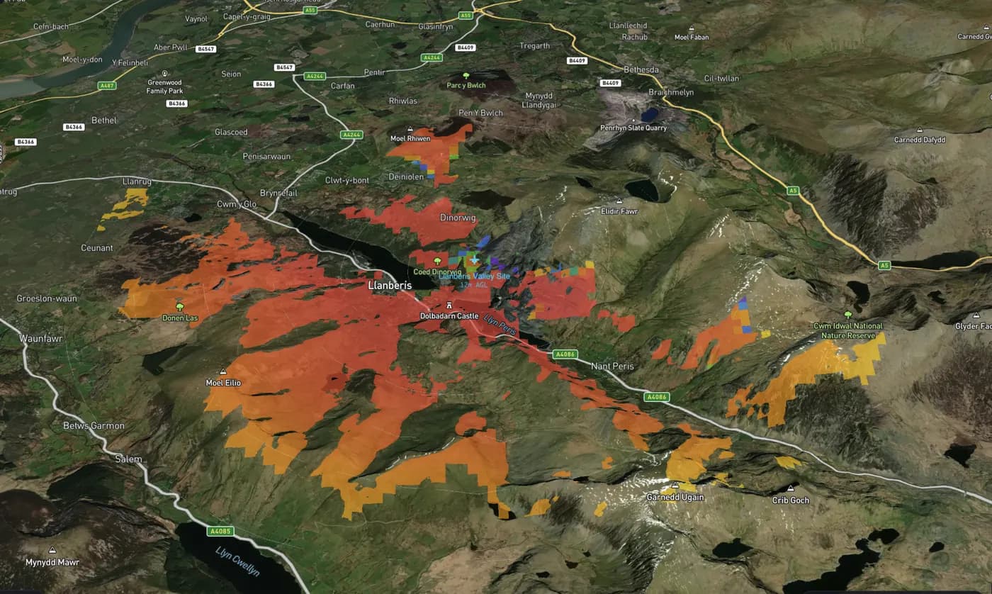
Computed air coverage starts with the selected radar's retained compatible CPU request and captured terrain. That input is sampled for probability of detection (Pd) at configured AGL altitudes. The spatial 3D threshold mesh and bearing-specific range–altitude sections derive from those retained field values; they are not a decorative dome or a second RF calculation. Interpolation uses finite cell support, so boundaries and selected-sample values have limited resolution.
AGL is above captured local terrain. Rendering uses captured ground height plus AGL at exactly 1× vertical scale. Source-native height consistency is not proof of a known geodetic datum or vertical accuracy. Basemap terrain is context, not a replacement for captured terrain.
The air-mesh threshold is separate from the completed 2D detector requirement. Changing it remeshes cached Pd, not RF. While remeshing is pending, requested and displayed thresholds may differ. Live controls must not relabel an older 2D result.
Antenna pattern, beam configuration, tilt, target RCS, and propagation/environment assumptions affect the prediction. No supplied field measurements or calibration are implied. Suitable site or flight validation is required; this output is not a guarantee.
Unavailable samples are not zero Pd, and surfaces do not bridge unknown cells. A terrain-obstructed path can retain finite predicted Pd under the applied model. Diagnostic observations may overlap; interpolation support observations are recorded support-cell flags, not independently measured causes or proof of dominant loss.
The first release renders one selected air volume. Other flat ground overlays are hidden while it is active, and normal 2D coverage returns on exit. Ground and maritime remain 2D. The volume is runtime-only, not a saved volumetric export. There is no claim of multi-radar volume fusion, mobile 3D, or native P.528 implementation.
Related: Technology · Propagation models · Changelog